

Land Measurement tools
নকশা প্রস্তুতের মৌলিক উপকরণ ও বিভিন্ন প্রকার যন্ত্রপাতির ব্যবহার
১৮৭৫ সনের সার্ভে এবং ১৯১৭ সনের (১৯৭৫ সনে সংশোধিত) টেকনিক্যাল রুলের উপর ভিত্তি করে মৌজা ভিত্তিক নকশা প্রস্তুত করা হয়। নকশা সরেজমিনের প্রতিচ্ছবি এবং ভূমি মালিকানা নির্ধারণেরও অপরিহার্য অঙ্গ। অর্থাৎ নকশা ও রেকর্ড পরস্পরের পরিপূরক। ভূমির সীমানা ও মালিকানা সংক্রান্ত বিরোধ নিষ্পত্তিতে নকশা অপরিহার্য। এই গুরুত্বপূর্ণ ভূমির নকশা প্রস্তত করার কাজে মৌলিক উপকরণ হিসাবে একটি পি-৭০ শিটসহ ( যে বিশেষ কাজের উপর নকশা অংকন করা হয়) বিভিন্ন ধরনের সার্ভে যন্ত্রপাতি ব্যবহার করা হয় । উন্নত বিশ্বে ভূমি জরিপে আধুনিক সার্ভে যন্ত্রপাতি ব্যবহৃত হলেও আমাদের দেশে মান্ধাতার আমলের সার্ভে যন্ত্রপাতি দ্বারা ভূমি নকশা প্রস্তুত করা যায়। তবে সুখের বিষয় বর্তমানে স্বল্প পরিসরে আধুনিক জরিপ যন্ত্রপাতি ব্যবহার করার কাজ আরম্ভ করা হয়েছে। ভূমি জরিপে ব্যবহৃত যন্ত্রপাতির নাম ও ব্যবহার নিম্নে উল্লেখ করা হল-
প্রচলিত উপকরন
১। পি-৭০ শিট : নকশা তৈরির মৌলিক উপকরণ হিসাবে একটি বিশেষ ধরনের মোটা গ্রাফ পেপার ব্যবহার করা হয়। এতে হালকা সবুজ কালারের লম্বায় ২৮ টি ও পাশে ২০ টি ১” -২০”* ৫৬০ বর্গ ইঞ্চি পরিমাণ স্থান রয়েছে । ট্টাভার্স জরিপ সম্পন্নের পর এ ধরণের সিটে ট্রাভার্স খুঁটির অবস্থান চিহ্নিত করা থাকে। এর উপর ভিত্তি করে আমিন গণ মাঠে সরজমিনের প্রতিচ্ছবি অংকন করেন । ছোট আকারের মৌজা হলে একটি শিটে একটি মৌজা আঁকা সম্ভব হয়। আবার বড় আকারের মৌজা হলে একাধিক পি-৭০ শীটে তা অংকন করতে হয়।
A theodolite is a precision optical instrument for measuring angles between designated visible points in the horizontal and vertical planes. The traditional use has been for land surveying, but they are also used extensively for building and infrastructure construction, and some specialized applications such as meteorology and rocket launching.
It consists of a movable telescope mounted so it can rotate around horizontal and vertical axes and provide angular readouts. These indicate the orientation of the telescope, and are used to relate the first point sighted through the telescope to subsequent sightings of other points from the same theodolite position. These angles can be measured with great accuracy, typically to milliradian or seconds of arc. From these readings a plan can be drawn, or objects can be positioned in accordance with an existing plan. The modern theodolite has evolved into what is known as a total station where angles and distances are measured electronically, and are read directly to computer memory.
In a transit theodolite, the telescope is short enough to rotate through the zenith, otherwise for non-transit instruments vertical (or altitude), rotation is restricted to a limited arc.
The optical level is sometimes mistaken for a theodolite, but it does not measure vertical angles, and is used only for leveling on a horizontal plane.
 |
fig 1: theodolite |
 |
| fig 2 : plane table tripod |
A plane table / plain table prior to 1830 is a device used in surveying and related disciplines to provide a solid and level surface on which to make field drawings, charts and maps. The early use of the name plain table reflected its simplicity and plainness rather than its flatness.
৪। গান্টার চেইন : এটি ভূমি পরিমাপের জন্য একটি বিশেষ ধরনের চেইন। এটির মোট দৈর্ঘ্য ৬৬ ফুট । এই ৬৬ ফুটকে ১০০ ভাগে ভাগ করা হয়েছে। প্রতিটি ভাগকে ১ লিংক বলা হয়। প্রতি ১০ লিংক পর পর চিহ্ন দেওয়া আছে। এই চিহ্নকে ‘ফুলী’ বলা হয়। এই ফুলীগুলো বিশেষভাবে চিহ্নিত করা হয়েছে যাতে ‘ফুলী’ দেখে কত লিংক তা সহজে বলা যায়। সে হিসাবে ১ ফুট = ১.৫১৫ লিংক হয়। মিঃ গান্টার নামের এক ব্যক্তি এই চেইন উদ্ভাবন করায় তার নাম অনুসারে এই চেইনের নামকরণ করা হয়েছে গান্টার চেইন ।
Gunter's chain (also known as Gunter’s measurement) is a distance measuring device used for surveying. It was designed and introduced in 1620 by English clergyman and mathematician Edmund Gunter (1581–1626). It enabled plots of land to be accurately surveyed and plotted, for legal and commercial purposes.
Gunter developed an actual measuring chain of 100 links. These, the chain and the link, became statutory measures in England and subsequently the British Empire.
 |
| fig 3 : Gunter's Chain |
 |
| fig 4 : Chain Pin |
 |
| fig 5 : Metal Scale |
The optical square uses a pentaprism to reflect and refract a beam or sighting 90 degrees, it is used in pairs in surveying and in a singular block in metrology.
In optical square A Horizon glass is placed at an angle of 120° with the horizon sight.
The Index glass is placed at an angle of 105° with the Index sight.
Angle between Index glass and Horizon glass is 45°.
 |
| fig 6 : Optical Square |
৮। গুনিয়া : সিকমি লাইন দ্বারা চেইন চালানোর সময় ডানে কিংবা বামে যে সকল অফসেট (আইলের কোনা, বাক ইত্যাদি) থাকে তা হতে প্রাপ্ত দূরত্ব নকশায় আকঁতে হলে ২ ইঞ্চি লম্বা একটি ছোট স্কেল যাতে ৯০ ডিগ্রী কোণ করে দাগ কাটা থাকে, যা নকশায় বসিয়ে অফসেটের অবস্থান নির্ণয় করে নকশা অংকন করা হয়। এই ছোট স্কেলটিকে গুনিয়া বলা হয়। এটি প্লাস্টিকের তৈরি এবং ১৬” =
১ মাইল স্কেলে এটি তৈরি করা হয়।
 |
| fig 7 : Gunia Scale |
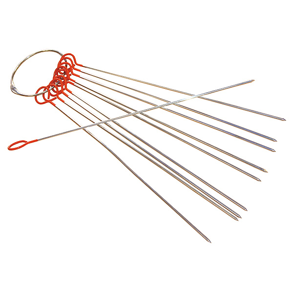
৯। লগি : চেই লাইন হতে অফসেটের দূরত্ব সহজে পরিমাপ করতে যে চিকন বাঁশের তৈরি খুঁটি ব্যবহার করা হয় তাকে ‘লগি’ বলা হয়। এটি সাধারণত: ২০ লিংক বা ১৩.২ ফুট লম্বা হয়ে থাকে। ৫ লিংক পর পর বিশেষ চিহ্ন করা হয়।
 |
| fig 8 : Logi ( লগি ) |
Dividers, a pair of compasses, as used for dividing lines, measuring, etc. a partition between two areas or dividing one area into two, as a piece of cardboard in a box or a bookcase jutting out from a wall.
 |
| fig 9 : Divider |
 |
| fig 10 : Acre Comb |
১২। ফ্লাট রুলার : সাধারনতঃ গুনিয়ার চেয়ে লম্বা লাইন এক বিন্দু হতে অপর বিন্দু পর্যন্ত সমান্তরাল রেখা অংকনের জন্য কাঠের বা প্লাস্টিকের যে স্কেল ব্যবহার করা হয় তাকে ফ্লাট রুলার বলে । এটি সাধারনতঃ ১২” দীর্ঘ হয়ে থাকে।
| fig 11 : Flat Ruler |
১৩। নর্থ কম্পাস : উত্তর ও দক্ষিণ দিক নির্ণয়ের জন্য নর্থ কম্পাস ব্যবহার করা হয় । সাধারণত: যে সকল এলাকায় দিক নির্ণয়ের সমস্যা দেখা দেয় যেমন বিশাল চরভূমি, পাহাড়িয়া এলাকা ইত্যাদি স্থানে আমিনগণ এটি ব্যবহার করে থাকেন।
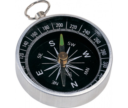 |
| fig 12 : North Compass |
 |
| fig 13 : Sprit Level |
১৫। টিন চুংগা / চোঙা : শীটের পরিমাপে টিনের তৈরি বিভিন্ন ব্যাসার্ধের চুংগা যার মধ্যে নকশা রাখা হয়। সাধারণত: আমিন সাহেব মাঠে যে চুংগা ব্যবহার করেন তা সিঙ্গেল শীট রাখার চুংগা। আবার যখন একাধিক শীট বহন করার প্রয়োজন হয় তখন বড় ব্যাসার্ধের টিন চুংগা / চোঙা ব্যবহার করা হয় ।
১৬। সাইট-ভ্যান : নকশা প্রস্তুতের প্রয়োজনে মাঠে ট্টাভার্স ষ্টেশন হিসাবে বাঁশের খুঁটি পোতা থাকে। জরিপ কাজের সময় অজ্ঞতাবশত: গ্রামের মানুষ এই সকল খুঁটি তুলে ফেলে। এই সকল নির্দিষ্ট খুঁটি খুঁজে বের করা, নতুন কোন ষ্টেশন তৈরি করা ইত্যাদি কাজের জন্য যে যন্ত্রটি ব্যবহার করা হয় তাকে সাইট-ভ্যান বলে। জরিপ বিভাগের হলকা অফিসার, কারিগরি উপদেষ্টা থেকে উপরের কর্মকর্তাগণ এটি ব্যবহার করে থাকেন। সার্ভেয়ার বা সরদার আমিনদের সাইট-ভ্যান ব্যবহার করার অনুমতি নেই।
 |
| fig 14 : Pantagraph
১৮। ক্লিনোমিটার : সাধারণত: পাহাড়িয়া এলাকায় পাহাড় পর্বতের উচ্চতা পরিমাপ করারর জন্য যে যন্ত্র ব্যবহার করা হয় তাকে ক্লিনোমিটার বলা হয়।
|
A clinometer is a tool that is used to measure the angle of elevation, or angle from the ground, in a right - angled triangle. You can use a clinometer to measure the height of tall things that you can't possibly reach to the top of, flag poles, buildings, trees.
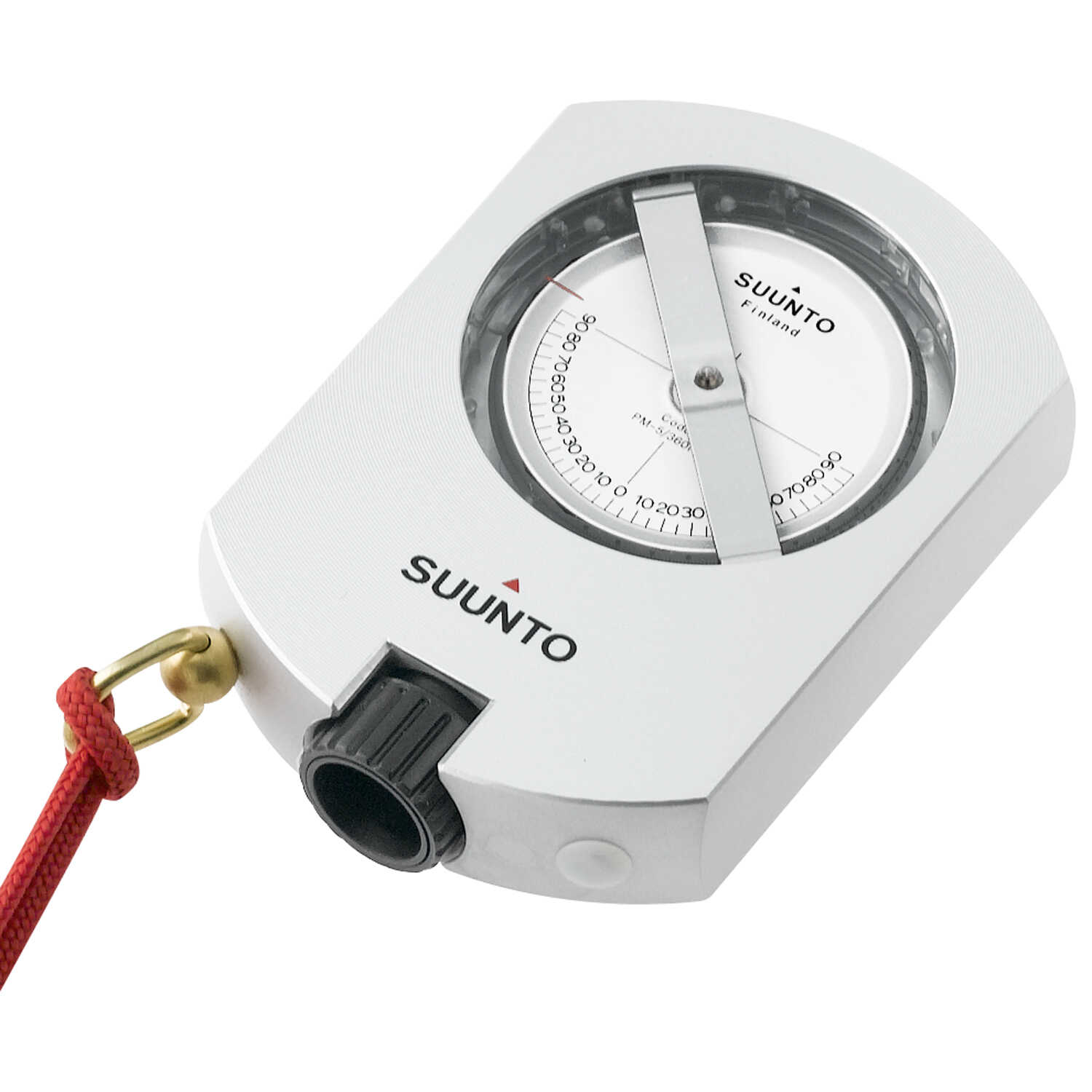 |
| fig 14 : Inclinometer or Clinometer |
১৯। ডিষ্টোমেট: নদী এবং পাহাড় পর্বতের অবস্থান থেকে অন্য স্থানের দূরত্ব চেইন দ্বারা নির্ভুলভাবে পরিমাপ করা যায় না। এ সকল স্থানে যে যন্ত্রের সাহায্যে বিনা চেইনে একস্থান হতে অন্য স্থানের দূরত্ব পরিমাপ করা হয় তাকে ডিষ্টোমেট বলা হয়। এই যন্ত্র দ্বারা কৌণিক ও রৈখিক দূরত্ব পরিমাপ করা যায়। বর্তমানে টোটাল ষ্টেশন দ্বারা এরূপ সকল কার্য সমাধান করা যায়।
আধুনিক জরিপ যন্ত্রপাতি
The Global Positioning System (GPS), originally NAVSTAR GPS, is a satellite-based radionavigation system owned by the United States government and operated by the United States Space Force. It is one of the global navigation satellite systems (GNSS) that provides geolocation and time information to a GPS receiver anywhere on or near the Earth where there is an unobstructed line of sight to four or more GPS satellites. Obstacles such as mountains and buildings block the relatively weak GPS signals.
 |
| fig 15 : GPS machine |
২। ইলেকট্রনিক টোটাল ষ্টেশন : টোটাল ষ্টেশন এক ধরণের থিওডোলাইট যন্ত্র। পূর্বের থিওডোলাইট দ্বারা কোন বিন্দুর কৌণিক দূরত্ব ও তারা পর্যবেক্ষণ করা হোত এবং চেইনের দ্বারা নির্ণীত দূরত্ব কম্পুটেশন করে কোন বিন্দুর স্থানাংক নির্ণয় করা হত। কিন্তু এই যন্ত্রটি দ্বারা ট্টাভার্স জরিপ করা হলে আলাদাভাবে কোন কম্পুটেশন করার প্রয়োজন হয় না। এটি নিজেই তা নির্ণয় করে দেয় । একই ভাবে এটি দ্বারা ক্যাডাস্ট্রাল জরিপের জন্য ডাটা কালেকশনও করা যায়। বর্তমানে বিভিন্ন ব্রান্ডের ও মডেলের ইলেকট্রনিক টোটাল ষ্টেশন পাওয়া যায়।
| fig 16 : ETS (Electronic Total Station ) |
 |
| fig 17 : Data recorder |
৪। ওয়ার্ক ষ্টেশন (কম্পিউটার) : বিশেষ ধরনের কম্পিউটার যার মাধ্যমে সংগৃহীত ডাটা নির্দিষ্ট সফটওয়্যারের মাধ্যমে প্রসেস করে নকশার আকার দেওয়া হয়।
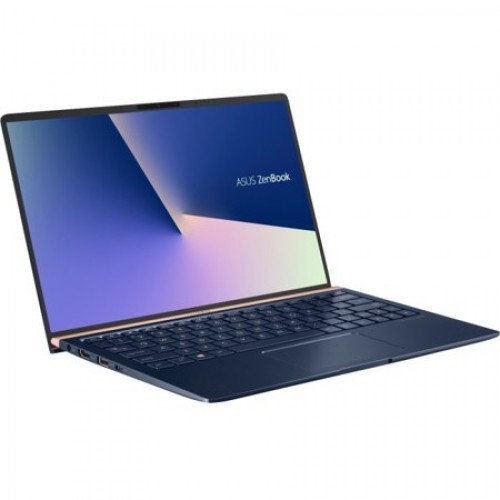 |
| fig 18 : Computer |
৫। প্লটারঃ নক্সা প্রিন্ট করার জন্য যে যন্ত্রটি ব্যবহার করা হয় তাকে প্লটার বলা হয়। আসলে এটি একটি বড় সাইজের প্রিন্টার। যার সাহায্যে ম্যাপ কিংবা তার চেয়েও বড় আকারের প্রিন্ট করা সম্ভব
 |
| fig 19 : Plotter |


No comments